
What is a Local Nature Recovery Strategy?
Local nature recovery strategies are being developed in 48 regions across the UK in response to both the global 30% Nature recovery by 2030 targets as part of the Kunming-Montreal Global Biodiversity Framework1 and the UK’s National Biodiversity Strategy and Action Plan2.
Local Nature Recovery Strategies are based on the principles of:
The Lawton Report 'Making Space for Nature' 20103
A Local Nature Recovery Strategy is about identifying the best places and actions or measures for nature recovery across a region. The LNRS will provide a framework for the wider region, specific areas such as nature reserves, sites of special scientific interest, wetland RAMSAR4 sites, as well as for smaller scale localities such as parishes, community groups or even individual gardens. The LNRS also provides a framework for more general and wider environmental improvements including public access to the countryside for recreation and well-being. It will be used as a decision-making tool for farmers, landowners and developers to guide Biodiversity Net Gain – a mandatory requirement of 10% uplift resulting from any land-use change. Farmers applying for the Sustainable Finance Incentive scheme will use the LNRS to enable them to understand nature recovery opportunities on their land. Businesses can also consult the LNRS in order to achieve their Environmental, Social and Governance (ESG) objectives.
West Northamptonshire and North Northamptonshire are two of the forty-eight authorities selected to formulate a LNRS because of the decline in biodiversity. Both areas are among those with the steepest levels of decline.
Within both districts the LNRS will identify potential areas for focussed actions with funding opportunities. These will be the best areas for nature recovery with immediate results but will also have wider environmental benefits.
Everyone can help nature thrive and encourage wildlife across West Northamptonshire. It is important at a local level that residents are able to foster a sense of ownership, responsibility and appreciation of nature which is vital in creating community cohesion. Nature really can enhance the self-worth of communities and their residents5.
The LNRS applies the principles of the Lawton Review, “MAKING A SPACE FOR NATURE” instructed by Hilary Benn in 2010 and led by Professor Sir John Lawton.
The Lawton Review cites:
‘the importance of ecological networks, suites of high-quality wildlife sites containing biological diversity, with connections between them enabling species, or their genes, to move. Establishing a coherent and resilient ecological network will help wildlife cope with change, but will also improve the ability of the natural environment to provide for us.’
To do this, Lawton says, we need to make our network of sites
BIGGER, BETTER, AND MORE JOINED UP.
This means:
- Protecting what we have while improving its quality with better management;
- Increasing the size of wildlife sites;
- Enhancing connection by creating new wildlife corridors or stepping stones;
- Creating new sites;
- Reducing pressure on wildlife by improving the wider environment including through buffering* wildlife sites
* buffering: protecting an ecosystem or habitat with another or ecotone. An example would be an area of shrub or nettles around a coppice woodland which would deter deer. Shrubs and dense vegetation by a stream protects the stream water against pollution. Ecotones are also habitats.
EXPLAINING THE LAWTON PRINCIPLES
BIGGER, BETTER, MORE, JOINED UP, PROTECTED from PRESSURE
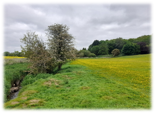
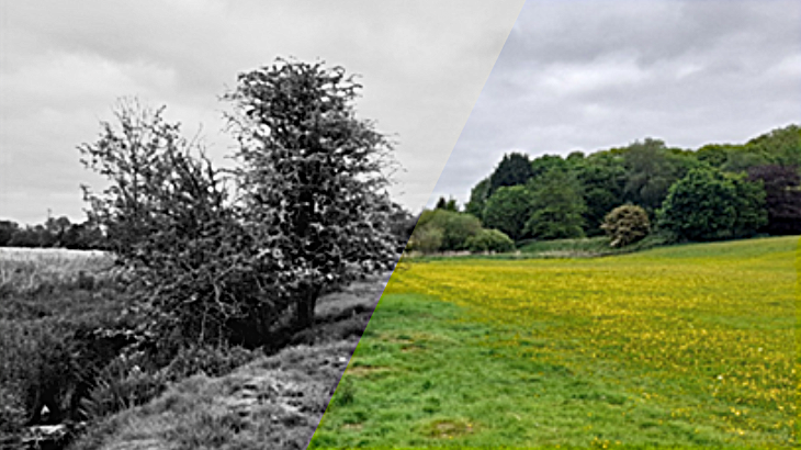
In order to explain how Lawton is used by the LNRS we can use the diagram below. It shows a MOSAIC or patchwork of habitats in any area of countryside rather like the photo.
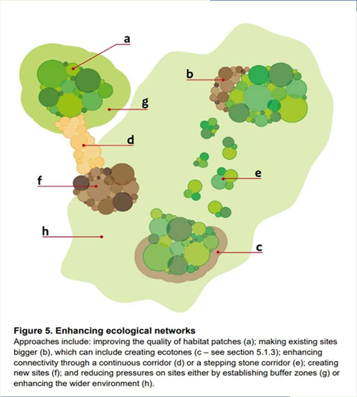
The diagram doesn’t include a stream but streams, rivers and wetlands act as very important connecting corridors as do hedgerows or lines of trees.
IN EXPLAINING LAWTON WE RETURN TO THE DIAGRAM AND CONSIDER THE WOODLAND.
a) Does this habitat need improving for example by introducing more indigenous tree species to encourage birds? – BETTER
b) Could this habitat be expanded while ensuring its quality, or could it be expanded without interfering with another priority habitat? – BIGGER
c) What other woodland patches are there? Are there any hedgerows which could be planted to connect patches of woodland or are there lines of trees? – JOINED UP AS A CORRIDOR
d) Is there a stepping stone corridor such as a hedgerow that has become divided that might be joined up? MORE JOINED UP/STEPPING STONES
e) Could more woodland be planted? MORE
f) How could we ease pressure or protect an area of woodland? Is there enough of a buffer zone of shrub or smaller trees around it (a transition zone or ecotone which is another ecosystem)? Does it need to be enclosed because of deer? – EASING PRESSURE and PROTECTION
The same criteria would apply to other habitats in the wider area and the LNRS would indicate potential for nature recovery within surrounding farmland or built-up areas and transport routes. The LNRS will inform planning decisions.
References
- https://www.cbd.int/gbf
- https://www.gov.uk/government/publications/uk-national-biodiversity-strategy-and-action-plan
- https://www.researchgate.net/publication/268279426_Making_Space_for_Nature_A_Review_of_England's_Wildlife_Sites_and_Ecological_Network#full-text
- A RAMSAR site is an area of wetland of international ecological importance. The RAMSAR convention held in RAMSAR, Iran in 1971 ratified the protection of such wetlands in 1975 and continues to do so. The Nene valley gravel lakes and washlands have the designation.
- https://www.westnorthants.gov.uk/country-parks-parks-and-open-spaces/local-nature-recovery-strategy/how-lnrs-will-be-used